© 2026 NervNow™. All rights reserved.
 ByNN Desk
Google Maps Ditches the Blue Line for a Smarter, More Human Way to Navigate
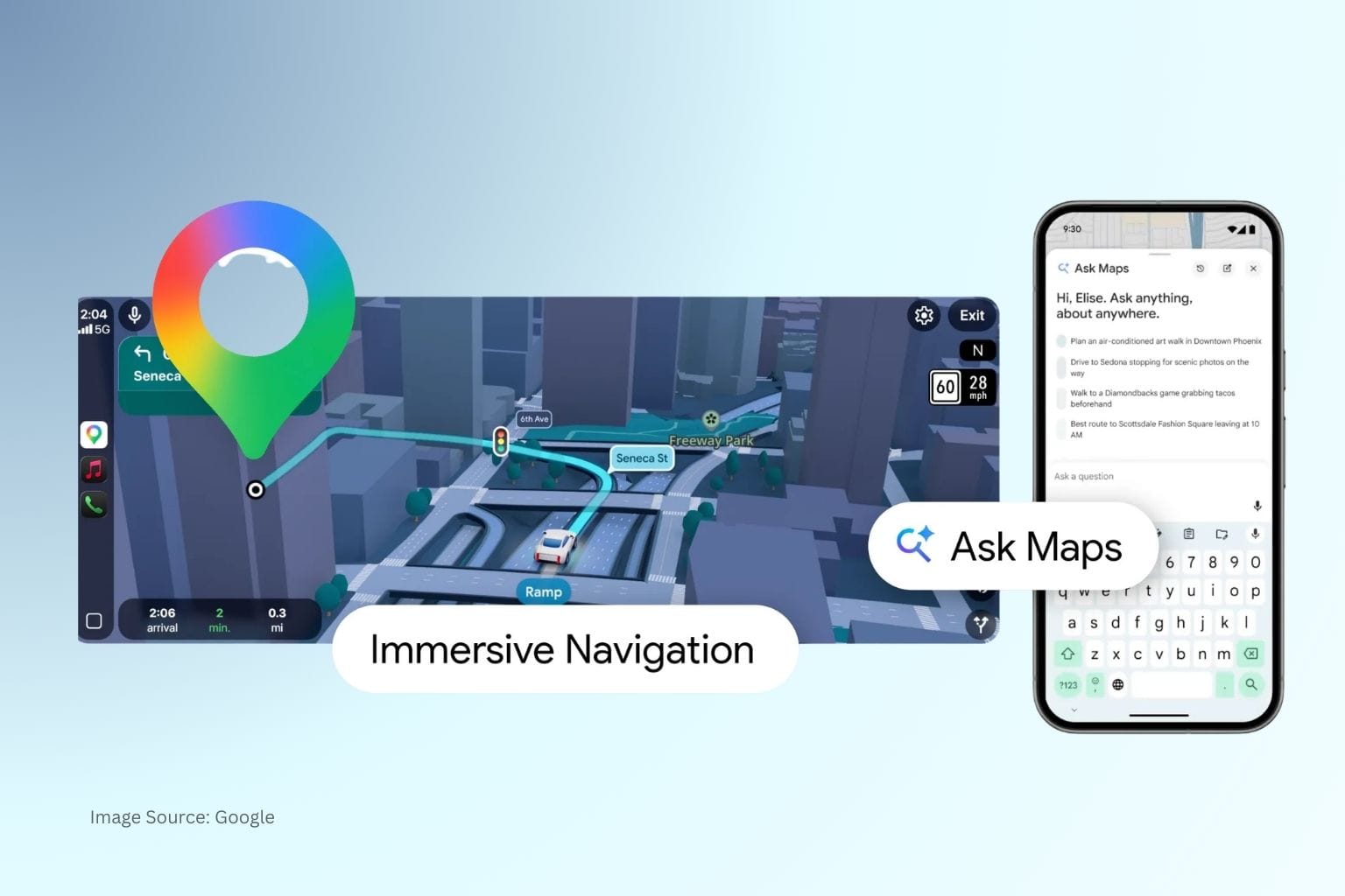
Two new Gemini-powered features, Ask Maps and Immersive Navigation, mark Google's most significant overhaul of its mapping product in over a decade. Both are rolling out now in the US and India.
Two new Gemini-powered features, Ask Maps and Immersive Navigation, mark Google’s most significant overhaul of its mapping product in over a decade. Both are rolling out now in the US and India.
For the better part of two decades, Google Maps has been very good at answering one question: how do I get from here to there? On March 12, Google announced it wants to answer a much bigger one: where should I even go, and why?
The first major new feature is Ask Maps, a conversational AI layer built on Gemini that allows users to ask complex, context-dependent questions directly within Maps. Rather than entering a search term and scrolling through results, users can now describe what they need in simple language: “Is there a public tennis court with lights I can use tonight?” or “Where can I charge my phone without a long wait?” and receive a response with a contextualised map attached.
Ask Maps draws on information from over 300 million places and inputs from more than 500 million community contributors. Google is positioning the feature as a way to surface the kind of contextual knowledge: hidden trails, free entry windows, and off-peak timing. This previously required users to manually sift through reviews or rely on word of mouth.
The feature also personalizes results based on a user’s existing search and save history in Maps, filtering recommendations to reflect demonstrated preferences without requiring users to re-specify them each time. From within the conversation, users can book reservations, save locations to lists, share them, or navigate directly without switching between apps or tabs.
Ask Maps is rolling out now in the US and India on Android and iOS. Desktop availability is coming soon.
ALSO READ: Google Rolls Out Gemini AI in Chrome to India, Canada, and New Zealand
The second feature, Immersive Navigation, is what Google is calling its largest navigation redesign in over a decade. The driving interface moves from the familiar flat, abstracted map to a detailed 3D view that reflects the real built environment: buildings, overpasses, and terrain, rendered using Gemini models trained on Street View imagery and aerial photography.
This means Maps can now highlight specific road infrastructure at decision points: lanes, crosswalks, traffic signals, stop signs, and medians. The map also expands its view ahead of complex turns and lane changes, giving drivers more time to react. Voice guidance has been updated to deliver more contextual, natural-language instructions rather than generic distance-based prompts.
On the data side, Google states that Maps processes more than 5 million traffic updates per second globally, and receives over 10 million community-reported incident contributions like crashes, construction, road closures, every day. Immersive Navigation will surface alternate route tradeoffs in real time, flagging the difference between a faster toll route and a longer toll-free one as conditions change.
The update also addresses the last mile: users can preview their destination via Street View before departing, receive parking recommendations, and get guidance on building entrances and which side of the street to approach from. Immersive Navigation is available today in the US across iOS, Android, CarPlay, Android Auto, and cars with Google built-in, with further markets to follow.
Source: Google The Keyword, official blog post by Miriam Daniel, VP & GM, Google Maps, published March 12, 2026.
MORE ON GOOGLE
Google AI is Helping Taiwan Predict & Prevent Diabetes at Scale
Google Launches AI Professional Certificate on Coursera
Alphabet’s Intrinsic Robotics Unit Officially Joins Google
Google Publishes 2026 Responsible AI Report Amid Growing Scrutiny